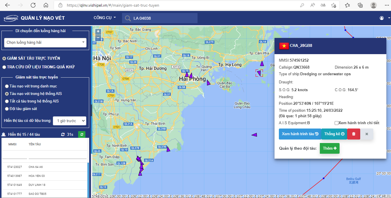
According to Decree No. 159/2018/ND-CP dated November 28, 2018 on “Management of dredging activities in seaport waters and inland waterway waters” and Circular No. 35/2019/TT-BGTVT “Regulations on dredging activities in seaport waters,” vehicles participating in dredging activities in seaport waters are required to install AIS equipment to manage, track, and store dredging vehicle trip data.
VISHIPEL provides AIS information services to serve the management of dredging vehicles and store vehicle journey data, including vehicle name, location, travel speed, stopping time, etc., from AIS equipment installed on vehicles participating in construction, transportation, and dumping of dredged material in seaport waters 25 to 40 nautical miles from shore.

Through AIS data sent from dredging vehicles displayed on digital maps, customers can capture ship information, including location information (longitude, latitude), speed, direction, and other identifying information, quickly and accurately.
With the advantage of ship information being continuously updated in a short period of time, management agencies can now fully grasp the ship's journey in as close to real time as possible.
AIS data from dredging vehicles is stored by VISHIPEL for a period of 3 years.